

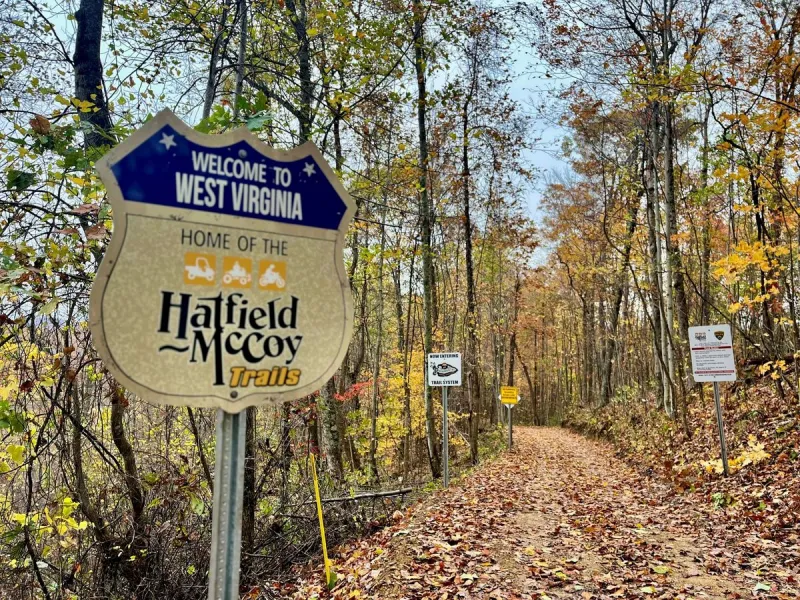
Hatfield McCoy Trails, the Ultimate ATV Adventure in West Virginia
Southern West Virginia is a place where the landscape does the storytelling. The mountains rise in steep, muscular folds. Hollows run deep and shadowed. Coal seams cut through the ridges like history written into stone. Here, the past—industrial, cultural, and mythic—sits close to the surface.
Threaded through this terrain is the Hatfield-McCoy Trail system, more than 1,100 miles of ATV and UTV trails that wind across ridgelines, through former coal towns, and deep into the heart of Appalachian America.
This is no fancy cruise vacation. It’s an immersion into the land, the people, and the history. It’s a crash course (hopefully not literally!) into Appalachia’s geology, folklore, and stubborn resilience where the mountains feel ancient and the people still greet strangers like neighbors.
If you’re looking for the best ATV trails in West Virginia, (and maybe even the USA!) you’ve found them.
What Are the Hatfield McCoy Trails?
The Hatfield-McCoy Trails are one of the largest off-road trail systems in the United States, stretching across nine counties in southern West Virginia. Originally opened in 2000, the trail network transformed old mining roads, timber routes, and mountain paths into a massive recreational system that now attracts hundreds of thousands of ATV riders every year.
Each system offers its own terrain, difficulty levels, and scenery—from beginner-friendly forest routes to technical hill climbs that make even experienced riders pause. What makes the Hatfield-McCoy Trails unique is the way they blend wilderness with small Appalachian towns. Riders can travel from a remote mountain ridge straight into town for gas, food, or lodging.
Today the system includes more than 1,100 miles of trails spread across 11 trail systems, including:
- Devil Anse
- Bearwallow
- Rockhouse
- Buffalo Mountain
- Pinnacle Creek
- Indian Ridge
- Pocahontas
- Cabwaylingo
- Warrior
- Trailhead (waterways)
- Outlaw Trails
About the Hatfield-McCoy Trails
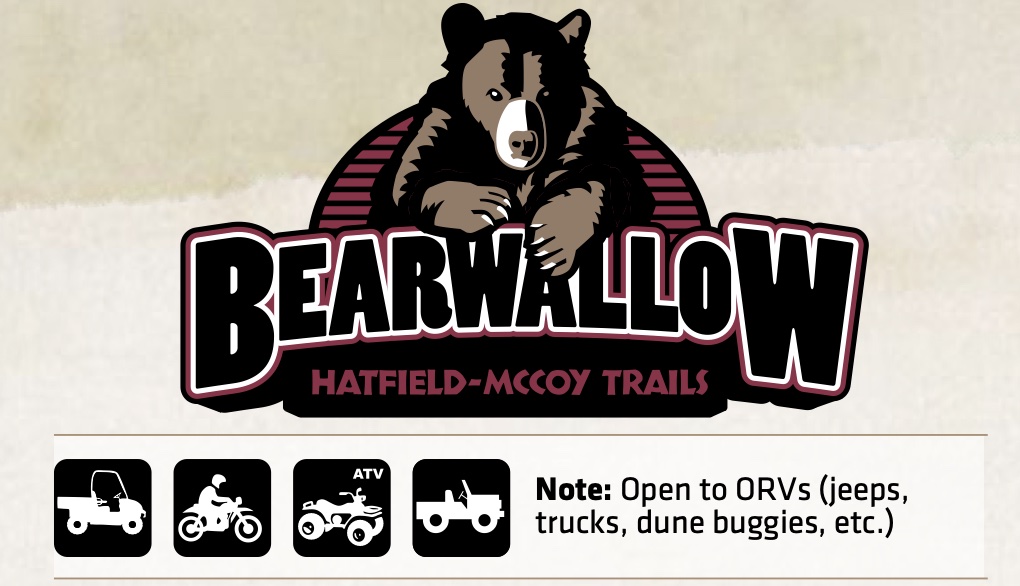
Bearwallow is located near the ATV-friendly town of Logan, WV. It is one of the original three systems of the Hatfield- McCoy Trails and is commonly known for its single track and Most Difficult-rated trails. Its mix of easy- riding scenic vistas and difficult trails make it one of the more popular systems for the Hatfield McCoy Trails. This trail system has direct access to gas, food and lodging. Bearwallow is open to ORVs as well as ATVs, UTVs and off-road motorcycles. ORVs must be equipped with rollover protection on black (Most Difficult) and red/black (Most Difficult) trails. Helmets are required.
Trail Breakdown
- Percentage of trails by difficulty level: 34%
- Easiest 39%
- More Difficult 14%
- Most Difficult 10%
- Most Difficult 3%
- Single Track
Amenities
- 2-acre parking area/Restroom facilities
- Permits and souvenirs available
- Bearwallow trailhead is staffed from 9:00 a.m. to 2:00 p.m., 7 days a week (except major holidays). All Hatfield-McCoy
- Trails are open 365 days a year from half an hour before sunrise until half an hour after sunset.
- The Country Roads Byways Visitor’s Center is located on Route 73 toward Logan. This visitor’s center provides access to the City of Logan connector to the Bearwallow
- Trail system. Access the Fountain Place Shopping Plaza by the Country Roads Byways Visitor’s Center connector.
Location
- 247 Bearwallow Drive, Ethel, WV 25076
- Direction: Driving north or south on US 119, take the Logan exit. Follow Rt. 73 east to Rt. 10 south. Pass the town of Logan and make a left onto Rt. 17 north. Go under the train trestle (Only 9’ high). Make a left onto Red Campbell Road. Make the second right and follow the road to the trailhead center. If you cannot fit under the train trestle, make a left onto Rt. 17 truck route, follow the signs to Rt. 17 north and make a left. Ten minutes from Logan.
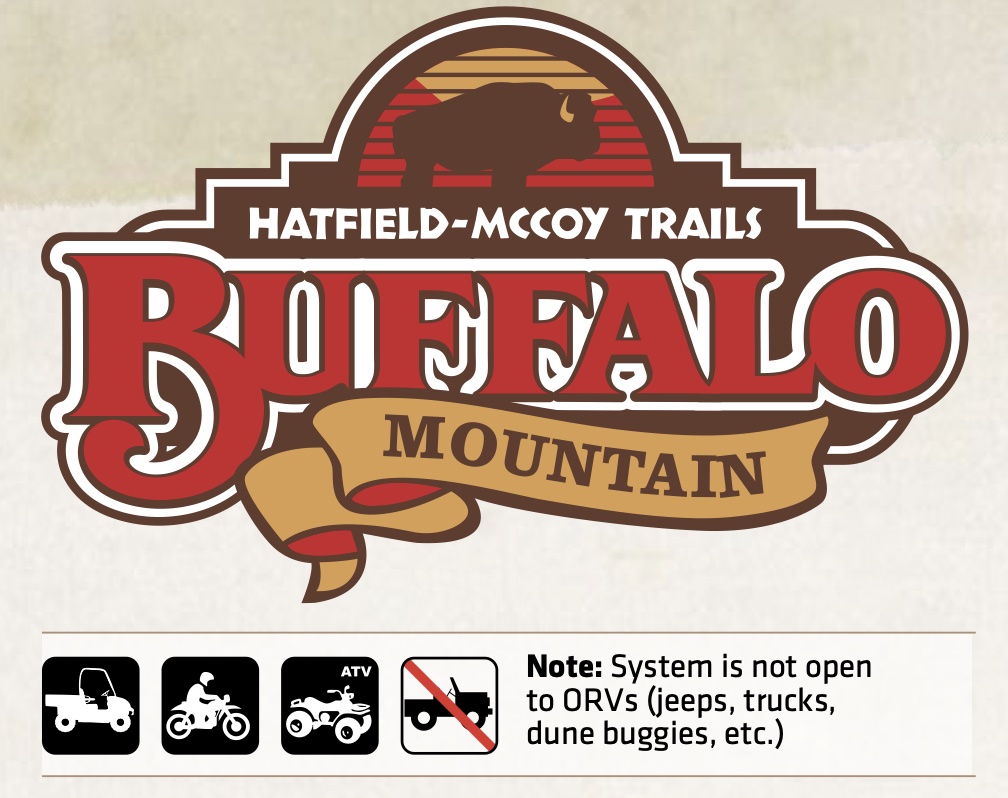
Buffalo Mountain is known as the most historic trail system, as well as the one with the most single track trails, making it incredibly popular with dirt bike enthusiasts.
This system has three community connectors providing direct access to the ATV-friendly towns of Delbarton, and Williamson, WV. Each of these towns offer gas, food, and lodging. This trail also connects with Devil Anse and Rockhouse.
Trail Overview
Historical Significance: Recognized as the most historic trail system in the Hatfield-McCoy network.
Terrain
- 28% Easiest
- 22% More Difficult
- 15% Most Difficult
- 4% Most Difficult (Extreme)
- 31% Single Track (Highly popular with dirt bike enthusiasts)
Amenities
- Connectivity: Connects directly with the Devil Anse and Rockhouse trail systems.
- Town Access: Features three community connectors providing direct access to Delbarton and Williamson, WV.
- Local Services: Both towns are ATV-friendly and offer gas, food, and lodging.
- Trailhead Facilities: * 2-acre parking area, Restroom facilities
- Permits and souvenirs available on-site
Location
- Address: 34 Oakwood Heights Road, Williamson, WV, 25661.
- Driving Directions: From US 119, follow US 52 south through Williamson. The trailhead center is located 8 miles outside of the city.
- Staffed Hours: 9:00 a.m. to 2:00 p.m., 7 days a week (except major holidays).
- Operating Hours: Open 365 days a year, from 30 minutes before sunrise until 30 minutes after sunset.
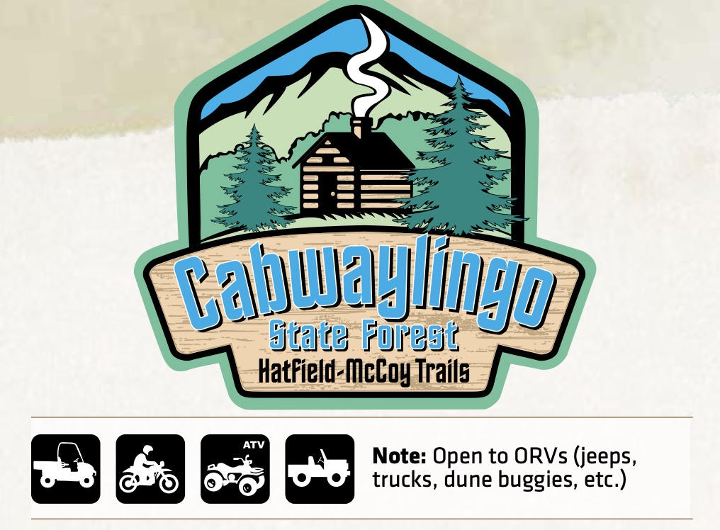
Cabwaylingo State Forest sits on nearly 8,300 acres of land in southern West Virginia. Its colorful name was chosen as a combination of the four closest West Virginia counties surrounding the forest – Cabell, Wayne, Lincoln, and Mingo. ATV, UTV, ORV (such as Jeeps) and dirt bike riders will find nearly 100 miles of new trails to explore, plenty of parking for trucks and trailers and a trailhead facility with trail permits and Hatfield-McCoy Trails merchandise for sale.
Terrain
- 54% Easiest
- 29% More Difficult
- 9% Most Difficult
- 0% Most Difficult (Extreme)
- 5% Single Track
Amenities
- Connectivity: Not specified (refer to area maps for forest-specific connections).
- Town Access: Provides access within the Cabwaylingo State Forest area.
- Local Services: For area lodging and attractions, please see pages 34-39.
- Trailhead Facilities: Large parking lot, On-site restrooms
- Permits and souvenirs available on-site (Merchandise)
Location
- Address: 39 Tick Ridge Road, Wilsondale, WV, 25699.
- Driving Directions: When traveling on WV-152 and approaching the Cabwaylingo State Forest, turn on Co Hwy 35/12 Pole Road and continue roughly 3 miles. The trailhead facility and parking area will be on your right.
- Staffed Hours: 9:00 a.m. to 5:00 p.m., 7 days a week (except major holidays).
- Operating Hours: Open 365 days a year, from 30 minutes before sunrise until 30 minutes after sunset.
Devil Anse Trail System links up to two other Hatfield McCoy Trail Systems- Rockhouse and Buffalo Mountain- totaling over 300 miles. The trailhead is located in the town of Matewan, historically known for being the heart of the Hatfield McCoy Feud. The trail system has direct access to gas, food and lodging
Terrain
- 26% Easiest
- 53% More Difficult
- 7% Most Difficult
- 1% Most Difficult (Extreme)
- 13% Single Track
Amenities
- Connectivity: Not specified (refer to area maps for connections to Buffalo Mountain and Rockhouse).
- Town Access: Provides direct access to the historic town of Matewan, WV.
- Local Services: For area lodging and attractions, please see pages 34-39.
- Trailhead Facilities: 2-acre parking area, Restroom facilities
- Permits and souvenirs available on-site
Location
- Address: Main Street, Matewan, WV.
- Driving Directions: From US 119, follow US 52 south to Rt. 49. Turn right onto Rt. 49 to the town of Matewan. The trailhead is located approximately half a mile on the main loop of Matewan.
- Staffed Hours: 9:00 a.m. to 2:00 p.m., 7 days a week (except major holidays).
- Operating Hours: Open 365 days a year, from 30 minutes before sunrise until 30 minutes after sunset.
ATV-Friendly Towns Along the Trails
One of the most unique aspects of the Hatfield-McCoy Trails is the number of ATV-friendly towns connected to the trail network. Riders can legally ride through many towns to access restaurants, hotels, and gas stations. Popular trail towns include:
- Logan
- Gilbert
- Matewan
- Man
- Williamson
- Bramwell
In many communities here, ATVs are street legal, meaning the trail system feels less like a park and more like an extension of everyday life.
About the Hatfield McCoy Trails
The Appalachian Mountains here are rugged, steep, and endlessly scenic. The trails follow this natural terrain through forests, ridgelines, and valleys carved by centuries of erosion. Riders experience scenic beginner trails winding through hardwood forests, intermediate climbs leading to panoramic mountain views, technical rock sections and steep hill climbs, and mud holes that appear even when the weather says they shouldn’t. With more than 1,100 miles of trail, it’s entirely possible to spend several days riding without repeating the same route.
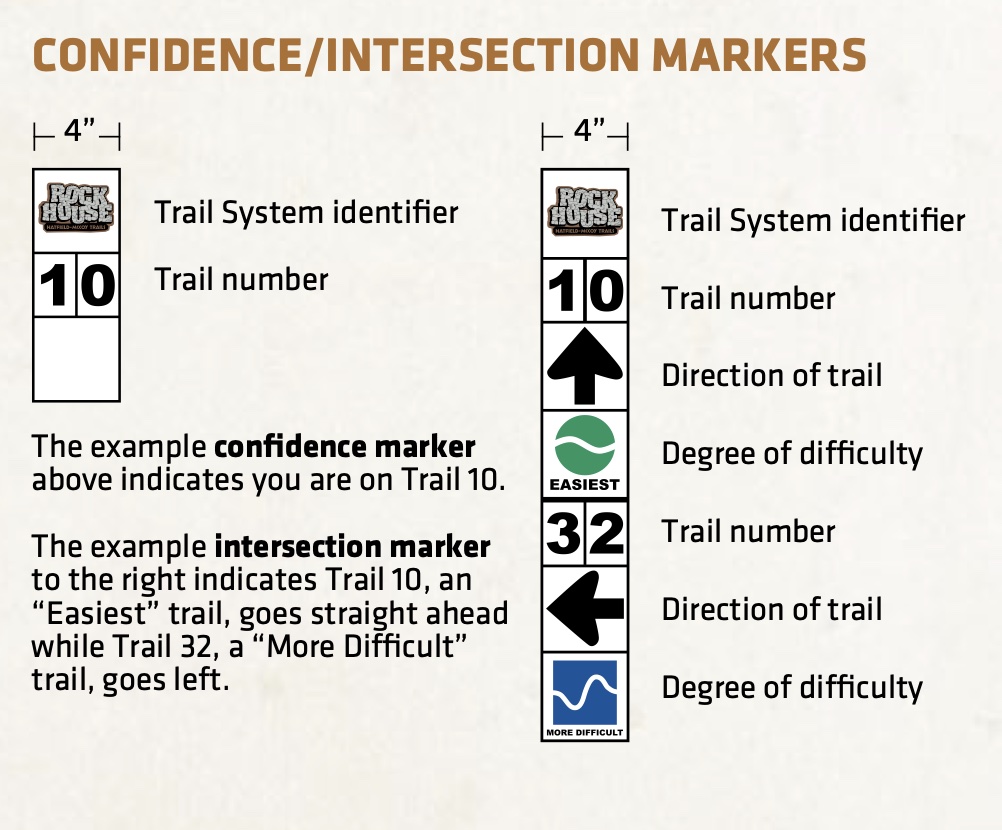
Trails are marked using a color-coded difficulty system similar to ski slopes:
- Green – beginner
- Blue – intermediate
- Black – advanced
Trail Management
No entry signs indicate off-limit areas. Temporary closure signs indicate a trail is closed due to construction or repair. Caution indicates trail hazard ahead. Other signs may signal a trail is heavily traveled with authorized non-trail traffic such as coal trucks, emergency vehicles, heavy equipment or land owners.
No entry signs indicate off-limit areas. Temporary closure signs indicate a trail is closed due to construction or repair. Caution indicates trail hazard ahead. Other signs may signal a trail is heavily traveled with authorized non-trail traffic such as coal trucks, emergency vehicles, heavy equipment or land owners.
Safety
The Hatfield-McCoy Trails provide users with a safe, legal and exciting place to ride. All trails are professionally mapped and patrolled by West Virginia Natural Resource Police Officers who enforce all safety laws and policies. Our staff performs daily maintenance to ensure the quality and safety of our trails and land.
Award-Winning
The award-winning Hatfield-McCoy Trails offer something for every skill level. The Hatfield-McCoy Trails have received praise from Dirt Wheels, ATV Action and ATV Magazine, as well as television features on the Outdoor and Discovery channels. All Hatfield-McCoy Trails are open 365 days a year from half an hour before sunrise until half an hour after sunset. You can ride to gas stations, restaurants, lodging, trailheads and more in our ATV-friendly towns.
“The Hatfield-McCoy trails are
Russ Ehnes, Executive Director of the National
probably the best known and
easiest to manage because they
are marked so well.”
Off-Highway Vehicle Conservation Council
Best Time to Visit the Hatfield-McCoy Trails
- The trail system is open year-round, but each season offers a different experience.
- Spring riding means lush forests, flowing creeks, and plenty of mud. Trails can be slick but incredibly scenic.
- Summer offers warm temperatures and long riding days, though dust can become an issue on dry trails.
- Autumn is widely considered the best time to visit the Hatfield-McCoy Trails. The Appalachian mountains explode with color, turning the forests into a landscape of red, orange, and gold.
- Some riders enjoy winter riding, though conditions can vary depending on snowfall and weather.
The Legendary Hatfield-McCoy Feud
The name Hatfield-McCoy isn’t marketing — it’s history. The infamous Hatfield-McCoy feud took place along the Tug Fork River, which forms the border between West Virginia and Kentucky. In the late 1800s, two families—the Hatfields of West Virginia and the McCoys of Kentucky—became embroiled in one of America’s most famous family conflicts.
The feud was fueled by all sorts of issues ranging from post-Civil War tensions, land disputes, timber rights, family pride, a forbidden romance, and even a “stolen pig”. William Anderson “Devil Anse” Hatfield became the patriarchal figure most associated with the feud. His reputation—part historical fact, part Appalachian folklore—still echoes through the region.
Today the feud has long since ended, but the mountains where it unfolded remain very much the same.
The History of Logan and Blair Mountain
The mountains surrounding Logan hold some of the most significant labor history in the United States. In 1921, more than 10,000 coal miners marched toward Blair Mountain, demanding union rights and better working conditions. The conflict, known as the Battle of Blair Mountain, became the largest labor uprising in American history. Miners faced private militias, company guards, and eventually federal troops. Though the uprising was suppressed, the event remains a powerful symbol of Appalachian labor history.
Today, the mountains that once witnessed labor battles now host one of the country’s greatest outdoor recreation systems. When you ride the Hatfield-McCoy Trails, you’re not just exploring off-road routes—you’re traveling through a landscape shaped by one of America’s most legendary stories.
Plan Your Trip
- Purchase User Permits from any staffed trailhead* or online at www.TrailsHeaven.com. Permits are also available at select retail locations.
- Pick a trail — or two or three!
- Arrange to stay.
- Gear up. Helmets and protective eyewear are required.
- Familiarize yourself with the Trail Rules
- Grab your ride and roll! Trails are open to ATVs, UTVs and dirtbikes. Select trails are also open to ORVs.
- Need a place to stay? Check out Buffalo Trail Cabins
Hatfield and McCoy Trail Fees
- WV RESIDENT $26.50
- NON-RESIDENT $50.00
- HOW TO GET A PERMIT
One permit provides full access to all Hatfield-McCoy Trail Systems. Permits are valid through December 31 of the calendar year purchased. Prices are subject to change and include 6% WV sales tax. Residents pay lower user fee due to West Virginia state tax dollars which help fund trail development. Valid West Virginia driver’s license required for Resident rate. One permit gives you access to over 1000 miles of trails for a full calendar year.
Military Discount
Military servicemembers and Veterans with a valid military ID can purchase a WV Resident User Permit regardless of their residency.
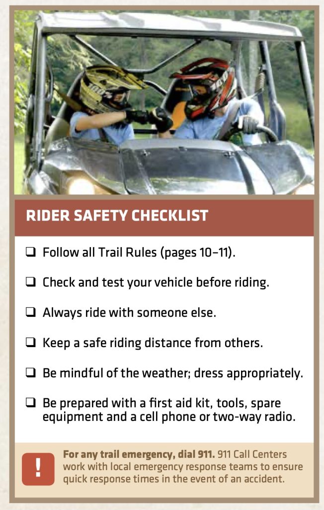
Tips for Riding the Hatfield-McCoy Trails
Before you hit the trails, keep these tips in mind:
- Bring goggles or sunglasses to protect against dust
- Carry water and snacks during long rides
- Download trail maps offline since cell service is limited
- Expect mud even during dry weather
- Ride within your ability level
Trail Rules
- User permit required for all drivers and passengers.
- Everyone must wear a DOT, Snell or other approved helmet and eye protection.
- All operators and passengers must meet manufacturer’s minimum age and size requirements.
- No one under the age of 6 is allowed on the trails under any circumstances.
- Any operator or passenger under the age of 16 must be under the direct supervision and within eyesight of their parent or guardian at all times.
- Obey all signs, gates and barriers, stay on marked trails.
- Trails only open during daylight hours.
- No littering, No camping, No fires.
- No alcohol may be consumed or possessed.
- No glass containers of any kind.
- Be aware of oncoming traffic, particularly in blind curves and hills.
- No competitions of speed, endurance or climbing ability allowed at any time without a special use permit.
- Operate at reasonable speeds and under control at all times.
- All machines must be equipped with a properly functioning muffler and USFS approved spark arrester.
ORV-Specific Rules
- ORVs are ONLY permitted on the Bearwallow,
- Cabwaylingo, and Ivy Branch trail systems.
- Everyone must wear a DOT, Snell or other approved helmet and eye protection.
- Driver and passengers must have valid trail permits.
- A valid driver’s license is required to operate an ORV.
- All passengers must be 8 years of age or older OR at least 6 years of age and 4’9” tall. No booster or car seats are allowed.
- Seat belts must be worn at all times. the number of passengers is limited to the number of factory
- installed seat belts.
- ORVs are required to have a roll cage on all most difficult (black and black/red) trails.
UTV-Specific Rules
- Everyone must wear a DOT, Snell or other approved helmet and eye protection.
- Wear seat belts at all times; the number of passengers is limited to the number of factory installed seat belts.
- Keep their hands, arms, feet, head and legs inside the
- No booster seats or car seats are allowed
- Possess a valid owner’s manual for the machine being operated that is able to be produced upon request.
- Stay on designated trails. UTVs are permitted on easiest, more difficult, and select most difficult trails
- UTVs must be equipped with a steering wheel and low pressure tires.
- Use Permits required for all operators and passengers.
Why the Hatfield-McCoy Trails Are Worth the Trip
The Hatfield-McCoy Trails offer far more than adrenaline. They offer a way to move through a landscape shaped by geology, industry, conflict, and community—a place where the mountains rise in soft blue layers and the air carries the quiet confidence of a region that has weathered everything and lost none of its soul.
What stays with you long after the ride is the people. Down-home, genuine, and unhurried, they welcome visitors with a warmth that isn’t performed—it’s lived. Conversations happen on front porches, in diners, at trailheads, and in gas stations that double as community hubs.
And then there’s the landscape itself. Sunlight catches on the ridges. Fog drifts through the hollows. The forests feel ancient in a way that reminds you how young the rest of the world is.
You come for the adventure.
You stay for the people.
And long after the mud washes off and the engines go quiet, what you remember most is the way the mountains made you feel — free.


